Figures, Not Feelings: What Culver City’s New Traffic Telemetry Says About Elenda
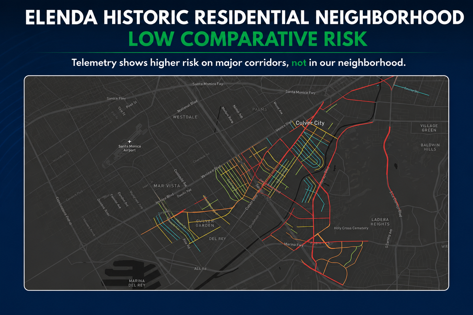
The City argued that traditional traffic counts do not adequately measure pedestrian and bicycle risk, which is why it adopted newer telemetry-based analytics through Replica. These systems use large-scale device and vehicle movement data to evaluate comparative roadway risk based on factors such as speeding, sudden braking, sudden acceleration, trip intensity, and other “risky driving events.” However, even under these newer methodologies, the historic residential neighborhood surrounding Elenda does not emerge as a significant comparative risk area, while major automobile corridors elsewhere in Culver City clearly do.
In other words, the City’s own telemetry appears to show that the most substantial risky-driving behaviors are concentrated on high-volume arterials — not within lower-volume residential school neighborhoods like Elenda. Residents are simply asking that future infrastructure decisions be guided by measurable comparative conditions.
Figures, not feelings.
One of the central arguments advanced in recent years by mobility advocates has been that traditional traffic engineering methods and raw traffic counts do not adequately capture potential pedestrian and bicycle safety hazards. That argument helped justify the adoption of newer telemetry-based methodologies intended to measure not just traffic volume, but also comparative behavioral risk, including speeding, sudden braking, sudden acceleration, and other “risky driving events.”
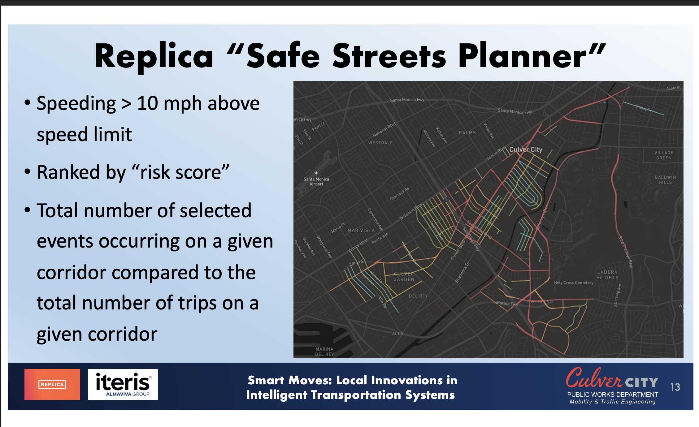
The City’s presentation to BPAC reflects that shift in methodology through the use of Replica’s comparative “risk score” framework. Importantly, however, even under these newer analytics, the historic residential neighborhood surrounding Elenda does not appear to emerge as a statistically significant comparative risk area within the broader citywide network.
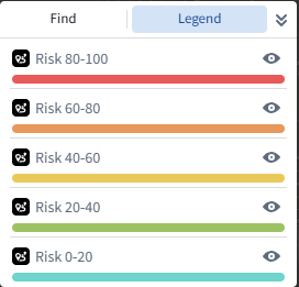
The December 2025 usage data appears to show substantial pedestrian activity alongside comparatively modest automobile volumes within the neighborhood, reinforcing the area’s function as a neighborhood-oriented environment rather than a major regional traffic corridor. At the same time, the City’s own Replica “Safe Streets Planner” telemetry analysis does not identify Elenda as a prominent comparative risk location. According to the City’s explanation, highlighted streets are ranked based on comparative “risk scores” derived from risky driving events and intersecting trip volumes, while uncolored segments likely lack sufficient data to generate meaningful comparative scores.
Notably, the Replica analysis does visibly identify other higher-volume areas of Culver City where speeding activity, risky driving behavior, and regional automobile intensity are substantially more pronounced. In that sense, the telemetry appears to reinforce what many residents already understand intuitively: the City’s most significant automobile behavior challenges are concentrated along major through-routes and high-volume arterials rather than within lower-volume historic residential neighborhoods like Elenda.
For streets where sufficient telemetry data does exist within the Tri-School area, the available information appears to reflect relatively low comparative risk levels rather than unusually elevated hazard conditions. That naturally raises an important policy question: if the City is now investing in advanced comparative risk analytics, will those measurable findings meaningfully inform future infrastructure prioritization decisions?
Residents are simply asking for transparent and consistent standards grounded in measurable comparative conditions rather than assumptions, preferences, or generalized narratives about mobility.
Figures, not feelings.