Please attend the 08/27/26 Mobility Committee at City Hall 6PM.
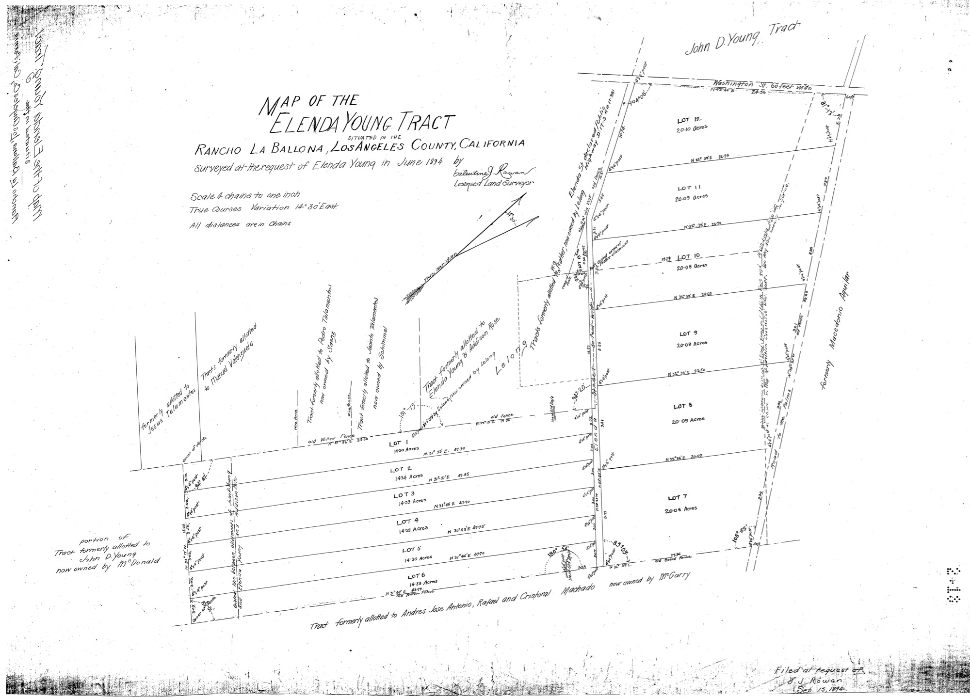
Elenda Young Tract
The Elenda Historic Neighborhood District traces its origins to 1894, when the land was first surveyed at the request of Elenda Young—whose name still defines Elenda Street today. The original Rancho-era parcels were later subdivided in 1927, creating the residential layout we know now, and the area was further anchored in the 1960s by a major storm-drain project that protects roughly eighteen blocks of homes surrounding Coombs Park and the neighborhoods adjacent to Veterans Park, east of Sepulveda and south of Culver Boulevard.
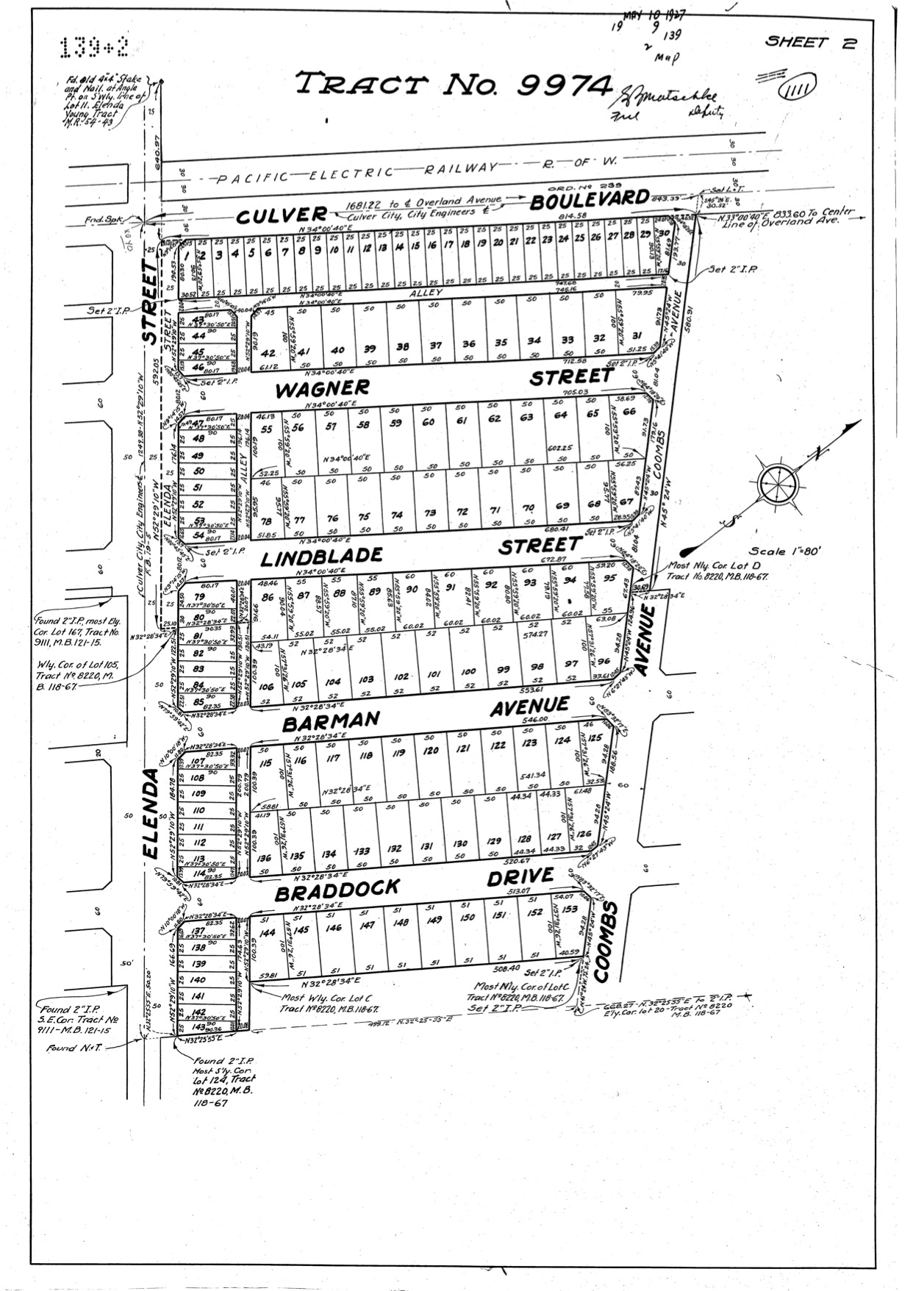
The 1927 subdivision shows the layout and street names that remain today. Note the Pacific Electric Railway running east–west along Culver Boulevard. Wide easements on Elenda and narrow alleys behind those homes reflect the original design. At the time of this map, the schools did not yet exist, and many ranch farms were still in operation, though not for much longer. Walking in this area was common then and remains so now because it was designed for people first: anchored by streetcar access, shaped by short blocks and service alleys, and built at a scale that still rewards life on foot. As tree canopies were planted along all of the streets, walking through a park-like neighborhood setting became the defining charm that endures today.
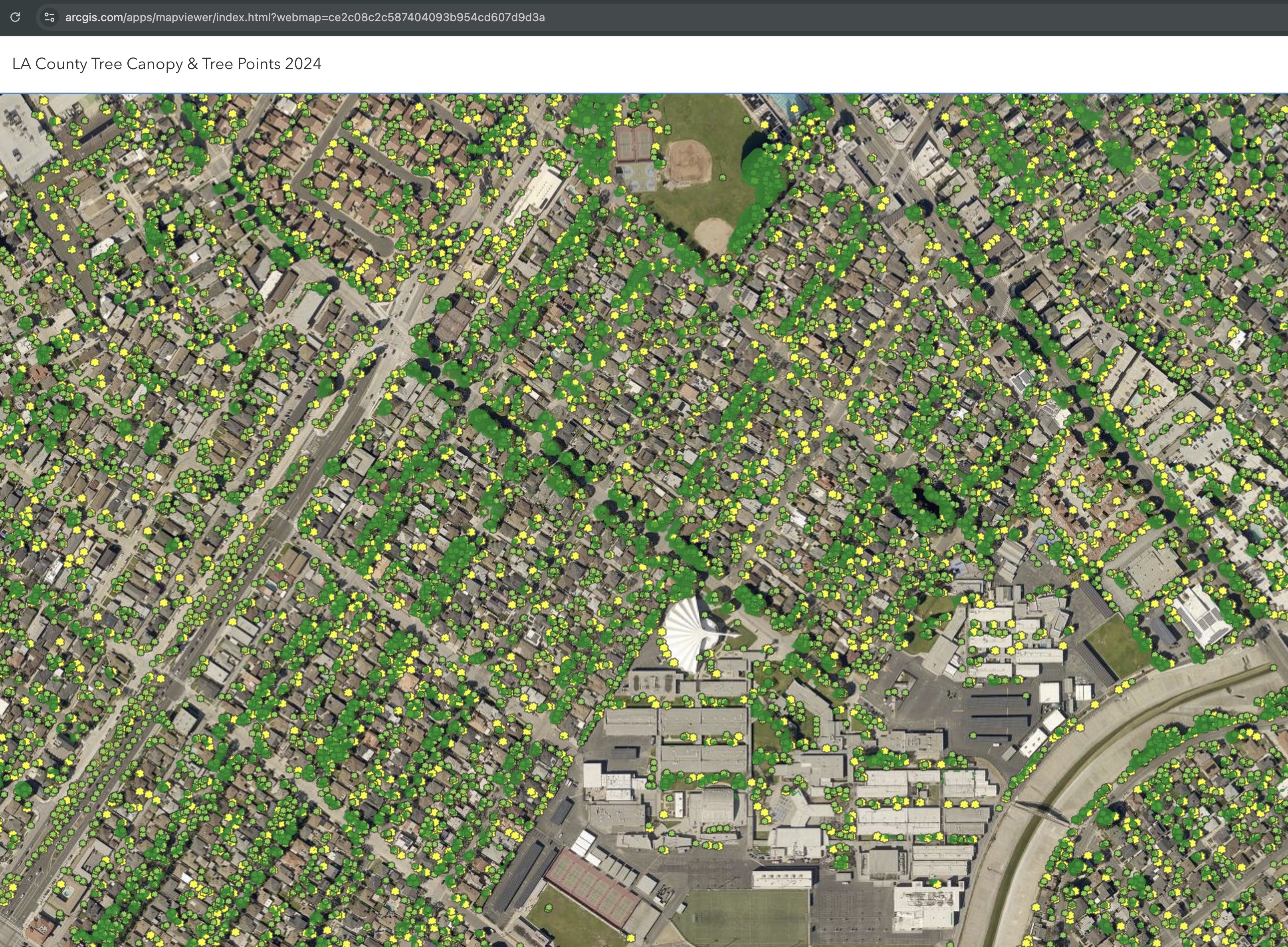
The 2024 Los Angeles County Tree Canopy map provides a detailed, high-resolution view of both overall canopy coverage and individual tree locations across the Elenda Young Tract Historic Neighborhood District. Using advanced aerial imagery and elevation data, the map highlights not only where trees exist today, but how densely they contribute to the area’s urban forest.
Tree canopy—the layer of leaves and branches that shades streets and homes—plays a critical role in cooling neighborhoods, reducing heat buildup, and improving air quality and overall quality of life. This visualization helps residents better understand the distribution of trees in the community and offers a useful baseline for preserving and expanding canopy coverage in the future.